Transit Oriented Development (TOD)

Stenciled Bikes

[caption id="attachment_1774" align="aligncenter" width="700" caption="Bike lane outside Schemata Workshop on 12th Avenue."]Bike Lane[/caption] 
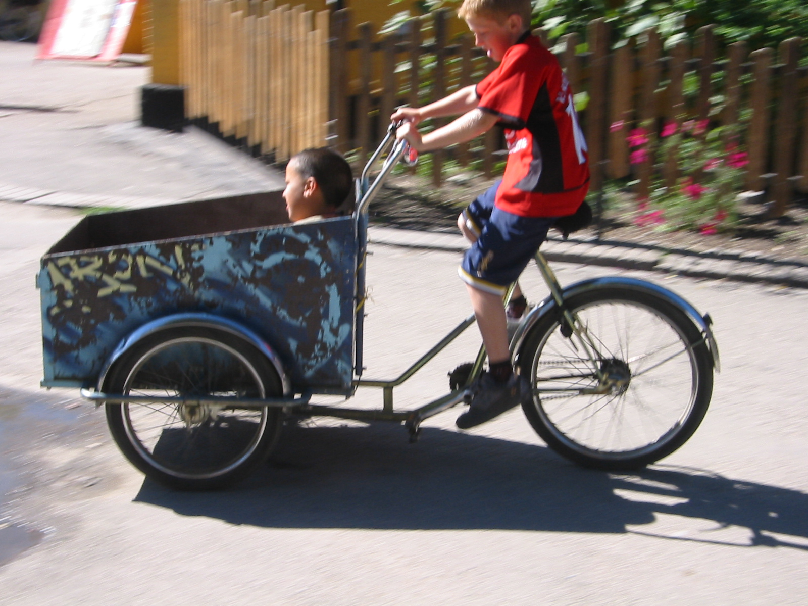
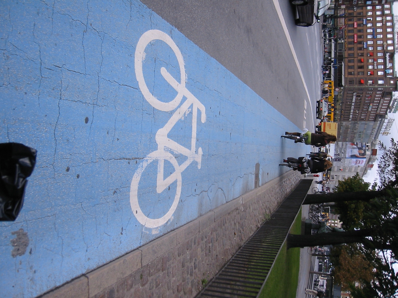
Much like Katherine I decided that May, official Bike to Work month, was a great opportunity to recommit to biking to work.  I was a fairly regular bike commuter five years ago when I worked downtown and lived in Greenwood but since then I’ve either worked close enough to walk to work or was on the road traveling for work.  The biggest difference I notice about biking now versus five years ago is all the new bike lanes, green bike lanes at intersections and sharrows (shared-lane markings) painted on the city streets.  These white stenciled bikes painted on the streets definitely make me feel like a more ligitimate user of the roadways.  As a biker I’m always hyper-aware of the dangers present when on the road.  Simple things can lead to dangerous accidents when you are on your bike such as a car door opening while passing parked cars, a car turning right across my path without noticing me, a car pulling out of a hidden driveway, the unaware driver at the four way stop who hasn’t noticed me, a newly formed pothole waiting to devour my bike, and the list goes one.  There are some drivers out there that get frustrated sharing the roadway with bikes but thankfully I have personally found those few and far between. The more common problems I’ve encountered with cars are that we bikers are just not super visible.  The good news is the image of my bike painted on the street seems to go a long way to remind my fellow car-driving road users that I and other bikers are also using the road. Seattle bike system may not be perfect and we have some ways to go before I would truly call us a bike friendly city but I am one biker that is happy with the direction we are headed.

On one of my evening rides home this month I decided to take a detour through downtown and head home along Dexter. It was fun to see the new road improvements currently underway that will create more buffered space between cars and bikes.  Later when I was looking up information about the construction I was surprised to learn that Dexter is one of the highest used bike lanes in Seattle but currently does not actually meet SDOT bike lane guidelines.  This is soon to be changed! The upgrade to Dexter will provide a substantial buffer between cars and bikes.  Most studies show buffers decrease serious bike-car accidents.  Dexter was originally slated for a Cycle Track, a two way bike lane separated from car traffic, but there was  debate on how much added safety (if any) these Cycle Tracks provide and if they were a actually a good fit for Dexter given the uses and layout of the street.  After community feedback the Dexter design was ultimately changed to provide buffer space between cars and bikes but not a Cycle Track.  That said SDOT has other Cycle Tracks proposed throughout the city. Community groups and SDOT are currently working to develop Cycle Tracks in a way that both increases bike ridership while providing added safety.

[caption id="attachment_1775" align="aligncenter" width="600" caption="Dexter road improvements currently underway will add buffered bike lanes."]Dexter Road Improvements[/caption]

Dexter and the proposed Cycle Tracks are not part of my daily Greenwood to Capitol Hill commute but I’m still very excited for these projects.  New bicycle road improvements encourage more car commuters to become bike commuters. More bike commuters increase bike awareness for drivers and bikers alike. More awareness leads to better and more creative solutions that keep bike commuters safer.  Safer bike commuters lead to more bike commuters…. It’s a feedback loop that will continue to lead us towards a more bike friendly Seattle. And this ultimately leads to a more environmentally friendly way to get all of us to work!

Rail-Volution Recap Part 3: TOD and Quality of Life

Apologies to all should I butcher any of the following, but the intricacies of transportation and Federal policy are new to me, but quite fascinating in the way they inform urbanism.

A Rail-Volution 2010 Plenary Session

Transportation planning has been too often been an end onto itself. For many years, transportation planners were (are) focused on efficiency as measured by the number of trips taken and speed of service.  Starting in the mid 20th Century, planning saw the automobile as a panacea for any transportation ailment; that is, until the roadways became so congested that the automobile created its own planning problems that it could no longer solve. It is true, efficiency (and I use this term in its quantifiable sense), should be an important metric; however, the funders of transit are realizing that qualifiable measurements are as -- or even more -- important.

A New Portland Park Adjacent to Transit

As an example in the emerging thinking, Federal funding mechanisms for rail transit, are being re-evaluated using a more holistic approach, one that includes quality of life as one of transit planning's highest goal. Historically, Federal grants have used a ‘one size fits all’ approach that uses the same criteria to award monies, regardless of geographical location or accounting for the externalities that often inform transit planning, such as public and environmental health or economic development. Because Federal funding is key to most all transit projects, the funding criteria (as enumerated in grant applications) have a huge impact on the design of transit, with its aforementioned traditional metrics stunting its opportunities in promoting quality of life. Applicants (transit agencies) are often forced to make ill-informed decisions that ignore leveraging transit investments in order to achieve other policy ends. Local knowledge and priorities of improving livability are sanitized or excluded, due to the Feds over-simplification of criteria to be those that can only be quantified. This results in many of the real benefits of transit remaining untapped (for instance, the improved pedestrian realm and its health benefits that usually accompanies transit corridor improvements may not factor into award criteria). Such myopic evaluation criteria is, of course, neither unique to Federal transit funding. Single or simplified criteria are easier to justify under scrutiny than those that are derivative of a policy, even when the derived benefits exceed the stated (applied for) goals of the project. This evolution of thinking, to include the many benefits of transit,  is exhibited in new Obama Administration directives such as the Sustainable Communities Initiative, that endeavor to see the linkages of the interactions of various federal departments and how their policies effect each other, promoting inter-agency coordinated in order to leverage common goals that may have previously been unidentified between departments. New questions are being raised, such as the FTA asking ‘What are the goals of the transit project, besides moving people’. How should local knowledge of health, employment, and environmental criteria be incorporated into and shape the basis of funding proposals?  Basic questions that should be asked, yet traditionally neither asked nor valued. Wording from the above mentioned directive:

[This] Partnership was conceived to coordinate Federal housing, transportation and environmental investments, protect public health and the environment, promote equitable development, and help address the challenges of climate change. Recognizing the fundamental role that public investment plays in achieving these outcomes, the [Obama] Administration charged three agencies whose programs most directly impact the physical form of communities—HUD, DOT, and EPA—to lead the way in reshaping the role of the Federal government in helping communities obtain the capacity to embrace a more sustainable future.

(http://www.hud.gov/offices/adm/grants/nofa10/huddotnofa.pdf)

By uniting theses two departments and one agency, the current administration is embracing the full possibilities presented by everything transit advocates have been lobbying for for decades.

A New Portland Park Adjacent to Transit

To many of us in the transit advocacy community (and increasingly to its funders) transit symbolizes more that rail or bus. It has become synonymous with other alternative (to the automobile) means of transportation, including walking and cycling. Both of this activities not only require no additional funding beyond the initial investment, but  also promote health, and are accessible means of exercise to all, regardless of income. What is exciting is that the health promoted by such activities can now be related in quantifiable means, satiating the appetite of planners for numerical data. One evaluate tool available is provided by the San Francisco Department of Public Health:  The Healthy Development Measurement Tool (http://www.thehdmt.org/), an on-line aid for evaluating healthful development practices. This tool has been used by municipalities such as the Denver Housing Authority to aid in their urban development projects, including TOD (Transit Oriented Development). The thinking is that transit promotes walking and cycling in several ways. First, getting to urban stations usually requires walking or cycling. Oftentimes rail corridor construction involves the redevelopment of the street cross section the tracks are set on, with the new section having enhanced sidewalks and bike lanes. Second, the compact, full service developments fostered by TOD makes walking or cycling the easiest way to get a destination,  including places of employment.  Years of research have shown the link between better sidewalks and bikeways in promoting walking and cycling. Given the nation's obesity epidemic, even the 15 minutes of walking or cycling a day goes a long way in promoting better health.

What is terribly exiting about this linking of transit and health is that it allows a robust campaign to be launched that includes powerful allies typically outside the circles of transit advocacy, such as physicians, nurses, and insurance companies; all who have a powerful voice in public policy. It also appeals to families, and especially women, who are generally the steward of their families well-being.  Healthful also better defines what quality of life means, an often ineffable term. Health is without question the cornerstone of quality of life, and a goal few can argue with.

Next Time: Partnerships Between Communites, Government, and Private Development.

Rail-Volution Recap Part Two: The Importance of Coordinated Planning

The very fact that Rail-Volution exists shows there is a growing understanding among transit advocates and agencies that the large investments in transit systems should leverage private enterprise to advance a community’s economic, social, and environmental agendas. This awareness between agencies of the need to coordinate policies is key to the successful Transit Oriented Development (TOD) around the Capitol Hill (Seattle) light rail station, and is in evidence by the unprecedented collaboration between Capitol Hill residents, advocacy groups, non-profits, and governmental organizations. Although such linkages seem obvious to many of us, the coordination of transportation and land use planning has been absent for quite some time. There is abundant evidence, however, that such coordination has a history. On a national scale, the construction of railroads was an imperative of the Federal Government's during the nineteenth century. Railroads were the mechanism used to secure the unpopulated western states and territories within the foundling republic. The Federal government gave away millions of acres, in the form of rights-of-way, to rail pioneers with the expectation that the commercial development that followed and its subsequent population growth would create not only wealth, but also population centers, peopling and thereby securing the American west against foreign intrigues and interference. In the 20th Century, the U.S. Interstate System was built and stands as the world’s largest construction enterprise. Expediting its execution were cold war polices centered on national defense, as well as the Federal Government's desire to stimulate post war development. One need only to look at the growth of the post war suburbs with its ubiquitous shopping malls –centered along interstate corridors -- to see the role transportation plays on land use, and the (unfortunate) consequences of a lack of coordination of transportation and land use planning.

Patton Park Apartments, Portland (image courtesy of REACH, Portland)

The urban sprawl resulting from the Interstate highway system had its social origins in the 19th Century and the industrialization of the country. During this time, a critical re-appraisal of the city occurred, due at least in part to the city’s often crowded and unsanitary living conditions. The physical (and social) reform of cities was championed by architects, planners, and sociologists and was centered around lessening congestion and pollution, as well as a romantic’s notion that a return to nature was the cure for the damaging effects of industrial progress. Beginning with the extensive commuter railroad suburbs of Chicago, New York, and Los Angeles, and culminating in the postwar boom in automobile use, the de-urbanization of the United States reflected changing social attitudes of how one ought to live. Instead of crowded and filthy cities, the notion held, one should move to so-called Garden Suburbs, a term associated with the English born thinker, Ebenezer Howard. The 20th century diaspora to the suburbs would not have been possible without the government financing of roads, whose construction was in turn exploited by private enterprise in the form of land speculation, road construction contracts, and automobile manufacturing. Unaware of the impacts of its action, government largess resulted in a myriad of unplanned consequences, including the need to seek additional revenues in order to increase capacity for such necessities as utilities, emergency services, and public institutions including libraries and schools. And though these services had been previously provided, insufficient (or no-existent) land use policies did not account for the ever longer networks of service needed for an increasingly less dense population. Public investment resulted in private investment that created a demand for greater (and less efficient) public investment, and in a self-sustaining (and unsustainable) cycle.

Today, our culture places greater value on social equity, environmental stewardship, and fiscal responsibility than previously held. Instead of fleeing to the suburbs, Americans are rediscovering the benefits of urban living, and the many lifestyle enhancements and financial benefits it provides. Most of the transit advocates at Rail-Volution understand this fundamental relationship between land use and transportation planning, and its impact on social constructs. Unfortunately, too many transit and planning agencies are still only beginning to make the connection between their respective actions. Even metro Portland, and its deservedly acclaimed MAX light rail, at first did not grasp this union in all its nuances. Witness its first light rail alignment (along Interstate 84, and built in the 1980s) which is spatially isolated from the neighborhoods it serves, therefore only tangential to those communities. Fortunately a quick study, Tri Met’s (Portland’s metropolitan transit agency) subsequent alignments have been strategically placed in order to foster community development and greater efficiencies by going through neighborhoods instead of around (or merely adjacent to) them. Success has lead to greater experimentation, with subsequent lines (such as Interstate) being used to pioneer re-development of economically distressed areas, with promising results.

Patton Park Apartments, Portland (Sally Painter Photography, courtesy of REACH, Portland)

The second of my field sessions at Rail-Volution bore witness to advances in Portland’s thinking. A coordinated effort between Tri-Met and the Portland Development Commission (PDC, the city’s increment financed public development and planning authority) led to the strategic investment of urban renewal funds and Federal Transit Administration (FTA) dollars to replace a notorious hotel with low-income housing, as well as to enhance a dying city park. The development of Patton Park Apartments’ was made possible in part by FTA dollars: because Tri-Met came in under budget on the new transit line, the FTA allowed Tri-Met to apply surplus contingency funds to write down the hotel’s property value making possible its purchase by REACH, a Portland non-profit housing developer. This allotment of transportation funding for housing aligned with the FTA’s policy of supporting “Highest and Best Transit Use”, a policy of theirs adopted in the late 1990s,  reflecting the evolving policy of leveraging private development opportunities presented by transit development. Concurrent to the housing construction was the dedication of urban renewal funds by PDC to the adjacent Patton Park, with its rejuvenation resulting in a neighborhood asset, providing recreation space for the new families of the new apartments.

Patton Park, Portland

Another low-income housing project visited that day was Humboldt Gardens, which is ½ mile from rail transit and surrounded on three sides by bus transit. The Housing Authority of Portland developed the project. Designed in a traditional style, its appearance is not as forward thinking as Patton Park, but it is without question a vast improvement to what was there, a fact not lost by the families it serves. As was the case with Patton Park, proximity to rail and bus transit was important for the development of this project.

Humboldt Gardens, Portland

Humboldt Gardens Resident, Portland

In both Patton Park and Humboldt Gardens, the positive impacts of  coordinated transportation and land use planning  achieved many community goals, ones that if pursued separately would be impossible or much more difficult.

For more information:

For further information on Patton Park Apartments: http://www.reachcdc.org/community/development/info/C112/ http://www.bizjournals.com/portland/stories/2008/04/14/focus2.html?jst=s_cn_hl

For Further information on Patton Park: http://www.pdc.us:80/ura/interstate/crownmotel.asp

For further information on Humboldt Gardens: http://www.hapdx.org/humboldtgardens/pdfs/HG-projectsummarysheets.pdf

Next: Developing Trends in Transit Oriented Development and FTA Financing

Rail-Volution 2010 Recap Part One

I am not much of a conference attendee. Preferring to immerse myself in books and lectures, conferences have seemed to me to be more about preaching to the converted, venues for vendors to hawk there wares, and a plethora of examples of how not to use PowerPoint; all coming at the expense of being a really useful way to become educated on a topic. Sloganeering and well rehearsed positions abound, unfortunately at the expense seeing a provocateur or hearing contrarian thinking. That being said, however, conference tours are usually a highlight, and, should one be fortunate enough, attending a presentation with an impassioned malcontent can add spice to otherwise banal fare. I must admit, however, that after attending Rail-Volution 2010 in Portland last week, my cynicism has abated; or, perhaps I am gaining a critical eye and am better at divining what the  larger lessons are.

The sessions I attended seemed to be predominantly peopled by land use and transportation planners, transit agency staff and directors, and transit advocates – architects (and urban designers) - were in the minority. Regardless of background, all attendees shared a passion for transit and transit oriented development (TOD), with presentations sharing strategies on how to best plan, design, and finance transit to increase our quality of life, be that reducing CO2 emissions or lessening our reliance on the automobile and its negative impacts on the public realm. To achieve these goals, the sessions approached transit from a compelling number of perspectives, including public health and safety, the role grant writing effects route planning, and just which parameters really should define a transit overlay district. Although most of the positions taken were safe, the sum total of them (the gestalt, as it were) represents progress in urban policy. More of this in future post, for today I wish to focus on first of two field sessions I attended.

The first of two field sessions I attended was a tour of the emerging South Waterfront/North Macadam District (it goes by either name), just southeast of Portland’s downtown. Zoned the same as the city’s central business district, this neighborhood is an example of how a city’s direct investment in transit was instrumental in developing an entirely new neighborhood, one where only vacant industrial land existed until less than 10 years ago. Built on former steel and ship building sites (a small barge building operation still exists), this brown-field is the area where Oregon Health Sciences University (OHSU) will (and has) expand their current land-locked campus. OHSU is the anchor for the re-development of over two dozen acres, and the school’s decision to expand in this area is attributable to the city’s building and financing of two forms of transit: an aerial tram connecting the new campus to the existing (located on Marquam Hill, about a mile west and 500 feet up), as well as a new streetcar line, connecting the OHSU campus to Portland State University and downtown. The city, university, and developers entered into an agreement that bound each party to a scope of work. Essentially, the city paid for the transit improvements, and private developers paid for a good portion of the development of the streets and the new buildings (which, in addition to OHSU include mainly luxury housing). Each party’s commitment was essential for this area to be developed, with the most crucial being the construction of an 80 person aerial tram. Beyond its aesthetic triumphs and novelty, the tram delivers a highly efficient form of transit, for instead of a 15 to 30 minute commute time that a bus would have entailed (Marquam Hill is too steep for rail), connections between the OHSU South Waterfront and Marquam Hill campuses is only three minutes for doctors, patients, students, and staff. Of almost equal importance in creating the backbone for the emerging neighborhood with the tram, was the extension of the city’s streetcar line, which provides a clear and direct connection through a maze of streets and changing topography from South Waterfront to Portland State University and downtown. Unlike connecting to Marquam Hill, a bus line may have worked made the connection, but a bus would not have had the same deliberative action and financial, aesthetic, and operational commitment rail transit provides in order for this nascent neighborhood to develop.

Given the state of our economy, assessment as to the success of South Waterfront needs to be made in the future. Portland, as is the case nationwide, is in an economic slump that has curtailed the previously rapid pace of development at South Waterfront. Still, the transit aspects are impressive -- if not down right exciting (nail biting?) -- and robust applause to all party's involved in creating South Waterfront's vision is in order. Taking derelict land, and reviving it with groundbreaking (air-breaking) transit solutions, will doubtlessly reap huge dividends for many years to come.

Next: Developing Trends in Transit Oriented Development, FTA Financing, and Low Income Housing

For Further Information on South Waterfront:                    http://www.pdc.us/ura/sowa_n-macadam.asp http://www.southwaterfront.com http://www.ohsu.edu/xd/about/facts/history.cfm